KirkbyMalham.info

KirkbyMalham.info
Home & News SearchWhat's new FeedbackLinksAmazon shop


About Social Bookmarking


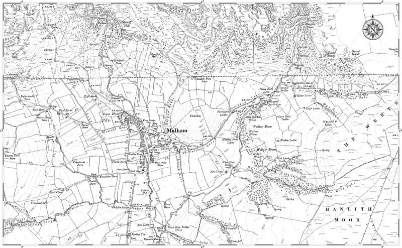
Malham village

1907 Ordnance Survey mapping

Malham, 1907.  (Neg. HOSM53115)  © Copyright The Francis Frith Collection 2006. http://www.francisfrith.com
Reproduced courtesy of The Francis Frith Collection.

You can purchase the full sized 6 inch to 1 mile version of this map rolled in a tube or ready framed, just click on the map image for details.

Search The Francis Frith Collection
Search:

Find other maps and photographs of the area on the Francis Frith website.

Reproduced courtesy of The Francis Frith Collection.


Malham, Mallam, Malum, Maulm, Mawm, Malam, Mallum, Moor, Moore, More, Kirkby, Kirby, Mallamdale, Mallumdale, Malhamdale, Malham-Dale, Kirkby-in-Malham-Dale, Kirkby-Malham-Dale, Kirby-in-Malham-Dale, Kirby-Malham-Dale, Hanlith, Hanlyth, Scosthrop, Scosthorpe, Skosthrop, Airton, Ayrton, Airtown, Calton, Carlton, Craven, Yorkshire, Otterburn, Otter Burn, Bellbusk, Bell Busk, Conistone Cold, Coniston Cold, Bordley, Bordly, Boardly, Boardley, Winterburn, Winter Burn, History, Local, ancestors, ancestry, Family, Genealogy, Geneology, Buildings, People, Maps, Census, Scawthorpe, Scothorpe, Scorthorp, Wills, Tax, Eshton, Asheton


Top of page
Search
Home and News


     © KirkbyMalham.info 2002-7                            Original page concept by Nordic Design                               web traffic=